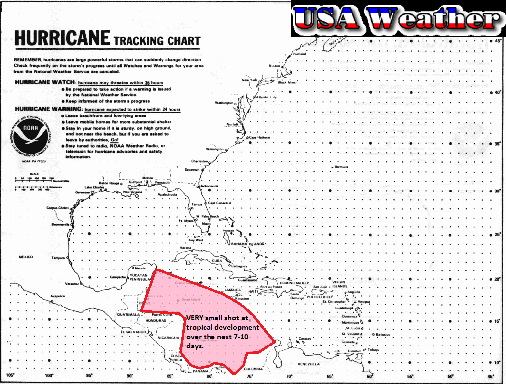
There is currently nothing to watch in the tropics in either the Eastern Pacific or Atlantic basins. However, a couple of computer models are suggesting that a small storm could develop in the Caribbean. At this time it is unlikely for a storm to form. We went ahead and made a map for you guys just so you can see the area we are watching:
The chance is very small as I already said. A few models are hinting at the tropical wave sitting in this area, but not developing it. In fact, at this time, only one model is developing this into a legitimate storm at this time, and it is the CMC, a computer model that is usually is way too aggressive. In other words, a storm this strong or even a storm in general is unlikely. Here is the image:
What I am talking about is that swirl of isobars just south of Cuba. That's all I have for now, stay tuned!