Well, we have lots of severe weather going on right now. There is a watch out, but right now there are also many mesoscale discussions out too, which could lead to the issuance of a watch. First, we have severe thunderstorm watch #679:
What we are watching right now is the clusters of thunderstorms currently ongoing. One in particular is severe thunderstorm warned just south of Des Moines. First, we are going to look at a radar reflectivity image of the cell:
We can see the warning on it covers the main precipitation core and a possible hook. Thus the threats for this storm look to be mainly winds and hail here, and the warning's text backs that up. Let's take a look at the best volume scanner image I could find using GR2Analyst:
I used this color filter for a combination of a cool effect and so that we could see every successive layer of this particular thunderstorm. First, the green outlines the general shape of the storm. Once we get down to the reds though, we are looking at the heavier rains, and possibly small hail. The red is generally what we look at for potential downbursts and tornadoes. This storm will likely not produce a tornado at the time of the post. And then we can notice the small core of pink inside the red on the left side of the image. Because it is taller than the red line, we can expect this to be a suspended hail core. Due to the small size, I really only expect hail up to around quarter size. As we get later in the period, we are going to become worried about a cluster of thunderstorms to develop in the watch area, with more widespread severe weather possible. We are also watching for the potential of a severe thunderstorm watch going up across this area:
It is because of a few thunderstorms that have developed that may become a cluster of thunderstorms capable of at least isolated wind and hail damage. Other than this, we don't see any more organized severe weather areas. However, there is some convection that may be producing at least short lived severe weather:
We'll also closely monitor this. Shear across this region is slightly higher than originally forecast, so at least some degree of organization may be achieved/maintained. Stay tuned!
Showing posts with label StormWatch. Show all posts
July 23, 2011
Severe Weather Update
Severe Thunderstorm Watch number 677 has been issued:
It has been issued for a line of severe thunderstorms capable of damaging winds. It is moving to the east. Right now we have minimal instability, which leads me to believe that the storms should weaken slightly. However, clear skies ahead of it should lead to the development of instability for it to work with, so it may begin to strengthen soon. In summary, I expect it to weaken for a while before it begins to strengthen again. Radar reflectivity shows a small bow echo:
A bow echo is a damaging wind producing storm. Thus, the main threat is wind damage. Stay tuned.
July 21, 2011
Severe Weather Update
I am simply going to run down the severe weather areas I am currently watching. First, we have the recently issued Severe Thunderstorm Watch #668 across Northwest Kansas, Southern Nebraska, and Eastern Colorado:
There are a few warnings out at the time of this post. We are also watching a line of strong thunderstorms that has developed across Southern Iowa, with a few warnings:
We do have a warning out for these cells, with more expected as the other strong storm/supercell at the east edge of the line continues to strengthen. We're also watching an area the SPC is worried about for potential watch issuance:
Stay tuned!
July 19, 2011
Severe Weather Update
Severe thunderstorm watch 664 has been issued:
Right now, we have a cluster of thunderstorms bearing down on the entire watch area. It is severe to intense, and has potential to become a bow echo as it evolves. It is currently tornado warned, but I do expect the main threat with this system to be wind damage. After yesterday, when I said that storms would sustain themselves only to watch them die before my eyes, I am at least a little bit hesitant to say that these are going to sustain themselves, but I guess I have to. So there you have it, I expect these storms to strengthen into a bow echo and trek through the region with the potential for widespread wind damage. Here is a look at the storms using GR2Analyst:
We do see a potential hook inside the red polygon, but the overall shape of the visible area is a bow, and one with the potential to strengthen. Stay tuned!
July 17, 2011
StormWatch: North Dakota
An extremely dangerous situation exists across North Dakota:
A storm capable of producing extreme hail has developed. Sorry for the shortness of the update. Stay tuned!
![]() |
| POSH and MEHS |
![]() |
| Reflectivity |
![]() |
| Large hail in pink |
![]() |
| Extreme hail inside white |
July 16, 2011
StormWatch: Burleigh County, North Dakota storm
We certainly found a gem of a storm out in North Dakota this morning. It has already left a trail of damage, and it's getting stronger. First, a reflectivity image:
We can see a core of intense precipitation, indicated by pink and black colors on radar. Next, we use our "new school" hail forecasting system again:
I put Probability Of Severe Hail on the left, with Maximum Estimated Hail Size on the right. In the core, we find a 100% chance of severe hail, along with maximum hail size estimates in excess of 3.5 inches. So we realize that we have quite the storm for morning-time. Now let's take a look at a volume scan:
In this scan, I isolated the 60dbz values (dbz is a measure of reflectivity). Generally, 60dbz is about the threshold when you look for hail. But in this case, there's so much purple, we have to isolate even higher values. In the next image we isolate 70dbz values:
The purple is still 60dbz, I left it in there to keep a feel of the storm's texture. But see that little core of white? That is the 70dbz core. We may be looking into the fact that rather extreme hail could exist in this storm. Stay tuned!
July 15, 2011
StormWatch: Douglas County, Minnesota storm
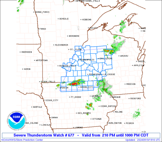
Here at USA Weather, we like to look into storms happening across the country. This morning we were surprised to find a few warnings out, so we took a look into one of them in Douglas County, Minnesota. First, a reflectivity image:
When I start WeatherSchool, I will teach you guys all about radar. But for now, we'll just say that reflectivity shows rain and hail intensity. We can see a core of heavy precipitation in the northwest quadrant of our storm. Next, we have base velocity:
This is an interesting product that doppler radar measures, showing the winds inside of a storm. We can determine the potential for wind damage with this. There is a small red dot pointing out the highest wind intensity. The winds here are above the ground though, so winds right around severe are expected, not quite as high as the image indicates. Now we use a new product called Vertically Integrated Liquid Density, or VILD:
This product has become known as one of the better hail size forecasters out there. The highest value is around four. This is a high total that is generally conducive to three inch plus sized hail. However, don't worry. I am not expecting hail that big. This is NOT a favorable time for large hail like that. We'll call this "old school" hail forecasting. It's cool, but only semi-accurate. Now we'll move on to "new school" hail forecasting:
The image above this text is called POSH, or Probability Of Severe Hail. There is a roughly 70% chance for severe hail next to that orange diamond that overlays the image. That is where we see potential for severe hail. Next, we use MEHS, or Maximum Estimated Hail Size. The radar is basically predicting the hail size:
Values top out at around 1.50" near the orange marker. We estimate hail will be around that size with this storm. Lastly, a volume scan:
The pink areas are potentially hail stored inside of this storm. This could be a nasty little storm. It is important to note that all images are from GR2Analyst. Stay tuned!
July 14, 2011
StormWatch: Alabama storm
There is a pretty hefty little storm cell sitting out in Alabama. Using GR2Analyst Edition, I have taken a volume scan of the storm:
I have isolated the higher reflectivity values to indicate possible hail. It doesn't look like a big hailer, however strong damaging winds are a distinct possibility with this cell. Stay tuned!
Subscribe to:
Comments (Atom)


